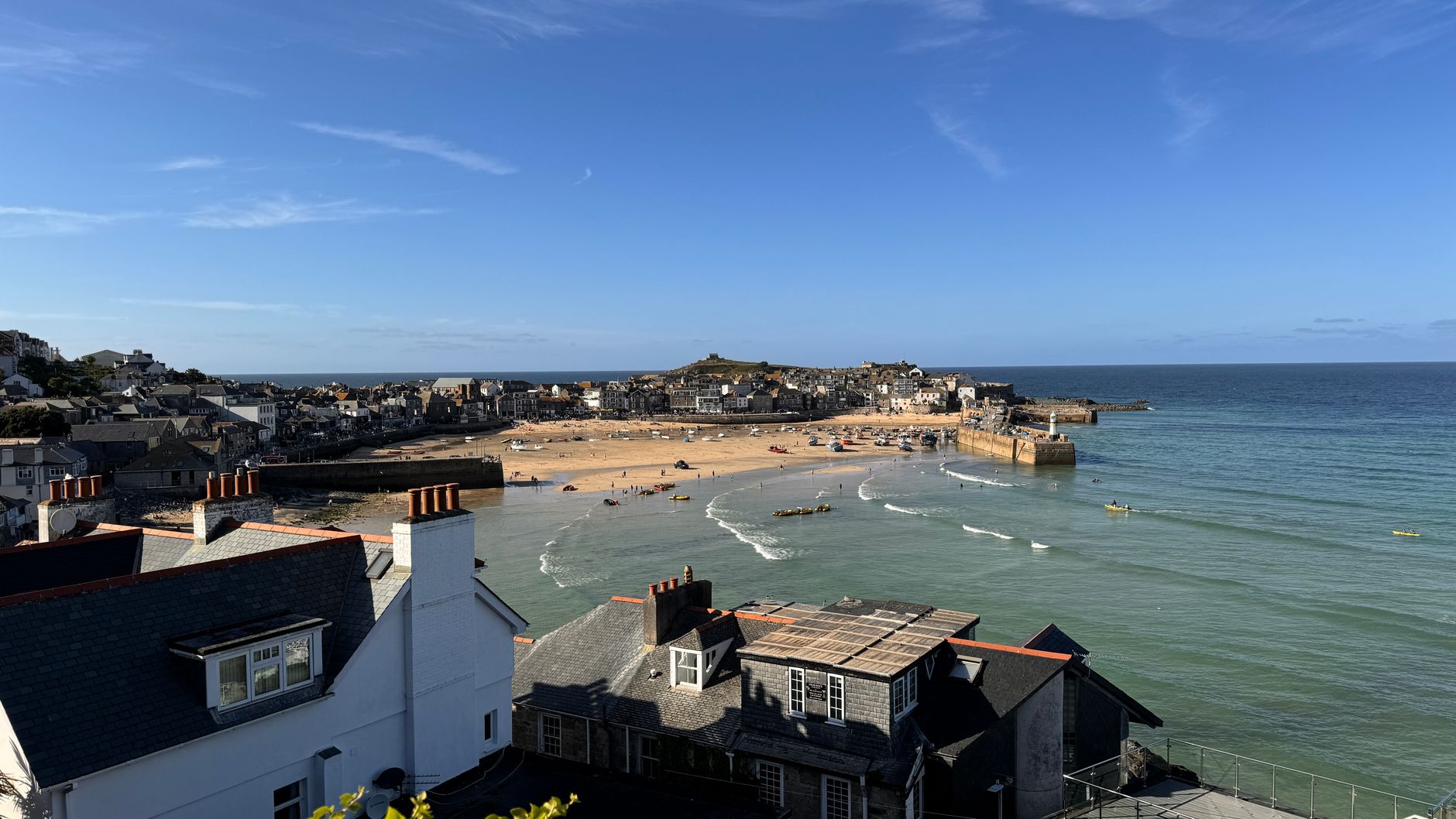
St Ives is one of the best walking bases in Cornwall, and it earns the title by geography alone. The town sits at the centre of a remarkable stretch of coast: gentle bay-edge strolls run east to Carbis Bay and Hayle, while properly wild Atlantic cliff walking begins the moment you head west towards Zennor and the Penwith heritage coast. Few places in Britain let you choose between an hour’s amble and one of the hardest sections of the South West Coast Path within three minutes of the same harbour.
This guide to the coastal walks near St Ives covers the routes most worth doing, with practical notes on distance, time and difficulty. There is an easy beach-to-beach option, a couple of classic intermediate walks, two tougher outings to Zennor, and the inland Coffin Path that pairs with them. Each entry flags parking and a pub or cafe stop. For the county-wide picture, our complete Cornwall walking and hiking guide sets the scene.
St Ives to Carbis Bay (and Back)
Distance: 5.5 km (3.5 miles) round trip.
Time: 1.5-2 hours.
Difficulty: Easy, with one short climb out of St Ives.
Facilities: Cafes at both ends.
The classic St Ives day walk. Start at the South Pier in the town and follow the coast path south past Porthminster Beach, through the gardens above Carbis Bay, and down to the beach itself. The route stays close to the railway line the whole way, which gives you an easy return option – a single stop on the train back to St Ives when little legs give out.
Best for
- Families with younger children.
- A morning walk followed by a swim at Carbis Bay.
- Pairing with the Tate St Ives in the afternoon.
Lunch Stop
Porthminster Beach Cafe sits right on the sand partway along (pricier, and worth booking ahead), or carry on to the options at Carbis Bay and back in the harbour.
Carbis Bay to Hayle Towans
Distance: 7 km (4.5 miles).
Time: 2 hours.
Difficulty: Easy to moderate, mostly flat with some sand.
Facilities: Cafes at both ends.
From Carbis Bay the path runs along the coast to Lelant Saltings, across the Hayle Estuary, and out onto the great dune system of the Hayle Towans. It is long, sandy and reliably uncrowded once you leave Carbis Bay behind. Return by train from Hayle, which keeps the walk one-way and the effort honest. This end of the bay connects with the sands covered in our guide to the best beaches near St Ives.
St Ives Circular via the Hain Walk
Distance: 6 km (3.5 miles).
Time: 2 hours.
Difficulty: Moderate.
Facilities: St Ives town.
From the town, climb the granite-flagged Hain Walk above the railway, follow the cliff path down to Carbis Bay, and return through the woods or along the railway path. It is the best way to see the bay from above without committing to a full day, and it loops back to your start with no bus required.
St Ives to Zennor via the Coast Path
Distance: 10 km (6.5 miles) one way.
Time: 4-5 hours.
Difficulty: Demanding; rocky, sometimes boggy.
Facilities: The Tinners Arms at Zennor.
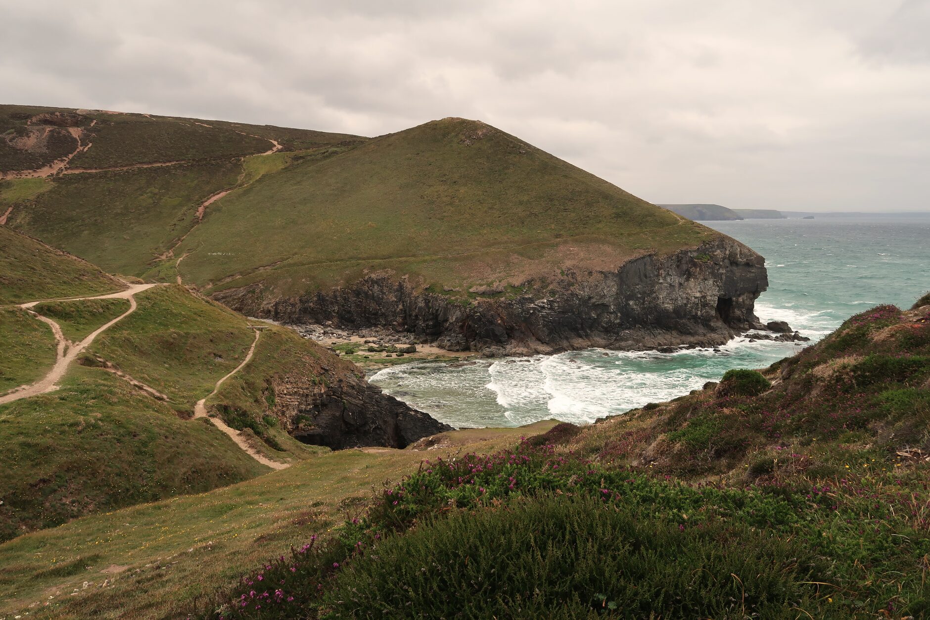
One of the toughest sections of the entire South West Coast Path, and one of the most rewarding. The route hugs the cliff west of St Ives through wild moorland, granite outcrops and ancient field systems that have been worked since the Bronze Age. There are no facilities until Zennor itself, so carry water and snacks. The climbs are steep and the going is slow – reckon on around 2 miles an hour, not the 3 you might manage elsewhere.
Most walkers do this one way and catch the bus back; the First Kernow service connects Zennor to St Ives. It is a walk that rewards an early start and a relaxed timetable rather than a race against the last bus.
St Ives to Zennor Circular via the Coffin Path
Distance: 16 km (10 miles).
Time: 5-6 hours.
Difficulty: Demanding.
Facilities: Tinners Arms at Zennor.
The classic full-day Cornish walk. You go out on the coast path, as above, and return on the inland Coffin Path – a granite-flagged route once used to carry coffins from Zennor to consecrated ground at St Ives, back when the little church at Zennor had no burial rights. The inland leg is gentler than the coast and quieter still, and the contrast between the two halves is the whole point.
Tips for the Zennor Walks
- Pack waterproofs even on a sunny morning – Atlantic cloud rolls in fast off the sea.
- Wear proper boots; trail shoes are not enough on the rocky, sometimes greasy sections.
- Allow more time than the mileage suggests. The published times assume a slow Cornish pace.
- Book a table at the Tinners Arms in season. The pub is small and fills quickly at lunch.
- Carry at least 1.5 litres of water each; there is nowhere to refill en route.
Around St Ives Head and Porthmeor
Distance: 2 km (1.2 miles).
Time: 45 minutes.
Difficulty: Easy, with a short climb.
Facilities: Town.
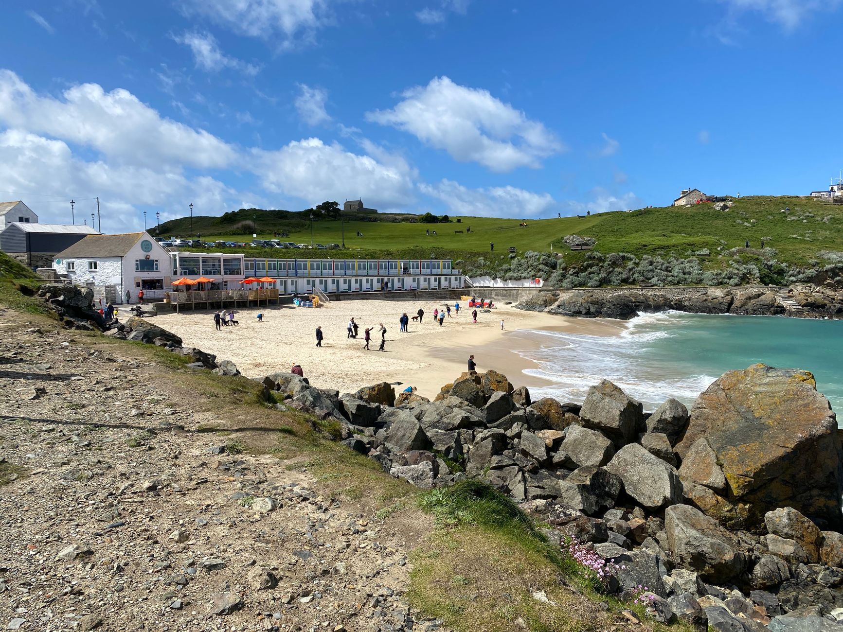
A quick stretch that is perfect before lunch or as the light drops. Start at the harbour, walk through the back of town to Porthgwidden Beach, around St Ives Head past the tiny St Nicholas Chapel, and back along Porthmeor Beach to the Tate. It packs three beaches, a headland and a chapel into under an hour, and it is one of the best sunset walks in the town.
Porthkidney Sands and Lelant
Distance: 8 km (5 miles) round trip from Carbis Bay.
Time: 2.5-3 hours.
Difficulty: Easy, mostly flat sand and clifftop.
Facilities: Carbis Bay or Lelant.
From Carbis Bay the cliff path runs past Hawkes Point and down to the vast, near-empty sweep of Porthkidney Sands, with the dunes and the church at Lelant behind. It is a brilliantly quiet beach walk for anyone wanting to escape the St Ives crowds, and the estuary birdlife at the far end is worth the binoculars.
The Wider Penwith Coast: Longer Walks West
Zennor to Pendeen Watch (12 miles)
The next section west of Zennor, and wilder still. Bosigran with its climbers’ cliff, the tors of Carn Galver, and the Pendeen lighthouse at the far end. Bus back along the coast road.
Pendeen Watch to Sennen Cove (10 miles)
Cape Cornwall, the Botallack engine houses hanging over the sea, and the long white beach at Whitesand Bay. UNESCO mining heritage and Atlantic drama in roughly equal measure.
Sennen to Land’s End to Porthcurno (10 miles)
The most westerly walking in mainland Britain, past Land’s End itself, the hidden cove at Nanjizal, and finishing above the Minack Theatre at Porthcurno. Spectacular from end to end.
Getting There and Parking
Parking in central St Ives is the town’s one genuine headache, and in summer it can eat an hour of your day before you have taken a step. The sensible move is the park-and-ride at Lelant Saltings or the Trenwith car park above the town, both of which feed into the branch-line train or a short walk down. Driving into the harbour itself in July and August is a false economy; the streets are narrow, the spaces few, and the wardens vigilant.
The St Ives Bay branch line is a walker’s secret weapon. It shadows the eastern walks almost exactly, so you can ride out to Lelant or Carbis Bay and walk back, or the reverse, without ever moving the car. For the western cliff walks to Zennor and beyond, the coast-road bus is the key link – check the day’s timetable before you set off, because frequencies thin out markedly outside the summer. Our Cornwall holiday planning guide covers how the trains and buses fit together.
Tides, Weather and Safety
The eastern beach walks are tide-sensitive at their edges. Porthkidney and the Hayle Towans are glorious at low water and much reduced at high tide, when the soft sand gives way to a narrow strip below the dunes; check a tide table if you are timing a walk around the beach rather than the clifftop. The estuary crossing at Hayle is a causeway, not a ford, but the mudflats either side are no place to wander.
West of St Ives the hazard is different. The Zennor cliffs are high, unfenced and genuinely remote, with long stretches out of phone signal. Keep to the worn path and well back from crumbling edges, turn inland if thick sea fog closes in rather than pressing on along a cliff you cannot see the edge of, and tell someone your route and rough return time before you leave. None of this is cause for alarm – it is simply the respect a wild coast asks for. Our wider Cornwall beach safety guide covers tides and rip currents in more detail if you plan to swim.
What to Expect Underfoot
The two halves of the St Ives coast could not feel more different. East of the town the walking is easy: tarmac paths, compact gravel, the odd stretch of firm sand, and a railway close by for a bail-out. West of the town it turns to bare granite, tussocky moor grass, boggy patches that linger long after rain, and steep little descents to stream-cut coves. The transition is abrupt – within a mile of leaving the harbour westwards you are on serious ground.
Footwear should be chosen for the harder half. Boots with ankle support and a good tread pay for themselves on the greasy granite towards Zennor, where a slip is easy and a twisted ankle a long way from help. Our full Cornwall walking packing list goes through boots, layers and the small extras worth carrying.
Making a Day of It: Town, Beaches and Galleries
The pleasure of walking from St Ives is that you are never far from something else worth doing. A morning on the coast path pairs naturally with an afternoon in the town – the Tate St Ives above Porthmeor, the Barbara Hepworth garden, and the maze of galleries and pasty shops in the old fishing quarter. Time an easy walk to finish at Porthminster or Carbis Bay and you can swim, eat and dry off before wandering back. The full picture of what the town offers beyond walking is in our St Ives travel guide.
The beaches deserve to be part of the plan rather than an afterthought. Porthmeor catches the surf and the sunset; Porthminster is the calm, family-friendly choice; Carbis Bay is the sheltered swimming beach at the end of the classic walk. Pack swimwear whatever the forecast says – the water on a warm day is hard to walk past, and a dip halfway round is half the reason to come.
Best Time of Year for Walking Near St Ives
- Late April to June: wildflowers on the western cliffs, long days and quieter beaches before the summer rush.
- July to August: warmest and busiest. The eastern walks and beaches fill; the Zennor cliffs stay relatively empty even in peak season.
- September to October: the sweet spot – a warm sea, settled light and trails that have emptied again.
- Winter: dramatic and bracing, with big Atlantic swells hitting Porthmeor. Shorter daylight and reduced bus services mean planning around the timetable.
Walks Near St Ives by Type of Day
Half Day, Easy
St Ives Head and Porthmeor (about an hour); Porthminster to Carbis Bay (two hours); the Hain Walk circular (two hours).
Full Day, Moderate
Carbis Bay to Hayle Towans with the train back; the Hain Walk circular extended along the coast; the Porthkidney loop from Carbis Bay.
Full Day, Challenging
St Ives to Zennor and back on the Coffin Path; or St Ives to Zennor one way with the bus home.
Multi-Day Trips From St Ives
St Ives to Penzance over three days, taking in Zennor, Pendeen, Botallack, Sennen, Porthcurno and Mousehole – arguably the most rewarding three-day stretch of coast path in Cornwall. Our guide to Cornwall walking holidays and luggage transfer explains how to arrange the beds and bag-carrying, and our guide to the best circular walks in Cornwall has more loop options for the days in between.
Where to Stay for St Ives Walking Holidays
The town itself gives the best access to the western cliff path; Carbis Bay and Hayle put you closer to the easy eastern walks and the branch line; Zennor is a tiny but characterful overnight base for anyone focused on the wild coast. Many local B&Bs welcome walkers with drying rooms, early breakfasts and packed lunches on request. See our guide to the best B&Bs in St Ives to pick a base.
The Coffin Path and the Story Behind It
The inland return from Zennor is worth understanding, not just walking. For centuries the hamlet of Zennor had no right to bury its own dead, so coffins were carried the six granite-flagged miles to consecrated ground at St Ives. The flat-topped stones you cross were laid partly to give the bearers a firm footing and a place to rest the coffin, and a few of the larger slabs are still known as coffin rests. Walking it now, with the sea out of sight and the moor rising on either side, gives the route a quiet weight that the busy coast path does not have.
It also makes for a very different walk underfoot. Where the coast path is all rock and steep descent, the Coffin Path runs at a steadier level through fields and past old farmsteads, following field boundaries that have barely changed in centuries. In poor weather it is by far the kinder half of the round, sheltered from the worst of the wind, though the granite slabs turn slick in the wet and the field sections can be muddy after rain. Do the loop in the traditional direction – out on the cliffs while you are fresh, back on the Coffin Path as the light softens – and you get the best of both.
Choosing Between the Coast Path and the Coffin Path
Not everyone should tackle the full Zennor round, and there is no shame in choosing the gentler option. If the group includes anyone unsure on rough ground, or the forecast is poor, walk out and back on the Coffin Path alone: it delivers the moorland and the sense of old Cornwall without the exposure and the relentless climbing of the cliffs. If you want the drama and have the legs, the coast path one way with the bus back is the efficient choice, saving the full circular for a long, settled summer day.
The one combination to avoid is attempting the full circular late in the day or in deteriorating weather. Ten miles of Penwith on tired legs, with the last bus long gone and the light fading on an unfenced cliff, is how straightforward walks turn into call-outs. Start early, carry a head torch just in case, and turn the day into the Coffin Path out-and-back if the weather closes in.
Common Mistakes on the St Ives Walks
- Treating the Zennor walk as a stroll. It is a serious hill day; the mileage badly understates the effort.
- Missing the last bus back. Check the return time before you start the one-way coast walk, and build in a generous margin.
- Wearing the wrong shoes. The eastern walks forgive trainers; the western cliffs do not.
- Underestimating the sun. The clifftops are shadeless and the sea reflects the UV; a hat and sun cream matter even on a breezy day.
- Driving into central St Ives in summer. Use the park-and-ride or the train and save yourself the circling.
A Note on the St Ives Bay Line
It is worth singling out the little branch line, because it shapes how you walk this coast. Running from St Erth junction down through Lelant, Carbis Bay and into St Ives, it hugs the edge of the bay for its final stretch and counts among the most scenic short rail journeys in Britain. For walkers it does two things: it turns every eastern walk into a one-way outing with an easy ride home, and it takes the parking problem out of the day entirely. Buy a return, walk the coast in whichever direction the wind favours, and let the train carry you back with sandy boots and a clear conscience.
FAQs: Coastal Walks Near St Ives
What is the best walk near St Ives?
For drama, St Ives to Zennor on the coast path. For an easy outing, St Ives to Carbis Bay. For a loop that returns to its start, the Hain Walk circular or the Coffin Path round.
How hard is the St Ives to Zennor walk?
It is one of the hardest sections of the entire South West Coast Path – demanding, rocky, sometimes boggy, with significant ascent. Allow 4-5 hours one way and take the bus back.
Are St Ives walks dog-friendly?
Most are. Some town beaches carry summer dog restrictions, but the cliff paths are open year-round. Our guide to the best dog-friendly walks in Cornwall has the details.
Can you walk from St Ives to Land’s End?
Yes – the coast path runs all the way. Allow three days: St Ives to Pendeen, Pendeen to Sennen, and Sennen on to Penzance. It is the most rewarding three-day section in the county.
Where can I park for the Zennor walk?
Use the St Ives park-and-ride at Lelant Saltings, or Trenwith above the town, and start from the harbour. Zennor itself has only a very small car park.
What is the best time of year for St Ives coastal walks?
Late April to June for wildflowers, and September to October for warm weather and quiet trails. Avoid the famous beaches in July and August if you want space.
St Ives is a walking town disguised as an art town. Pick a route to suit the day, take a packed lunch, and the coast does the rest. Few short walks in Britain manage to fold gallery, beach and Atlantic cliff into a single afternoon the way a few hours from this harbour can.