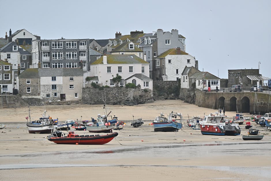
St Ives is one of the best walking bases in Cornwall. The town sits at the centre of a remarkable stretch of coast: gentle bay-edge walks east to Carbis Bay and Hayle, and properly wild Atlantic cliff walking west to Zennor and the Penwith heritage coast. Few places in the country let you choose between an hour-long stroll and one of the hardest sections of the South West Coast Path within three minutes of the same harbour.
This guide to coastal walks St Ives covers the routes most worth doing, with practical distance, time, and difficulty notes. We have included an easy beach-to-beach option, two classic intermediate walks, two tougher loops to Zennor, and the inland Coffin Path that pairs with them. Each entry has parking and pub-lunch tips.
St Ives to Carbis Bay (and Back)
Distance: 5.5 km (3.5 miles) round trip.
Time: 1.5–2 hours.
Difficulty: Easy, with one short climb out of St Ives.
Facilities: Cafes at both ends.
The classic St Ives day walk. Start at the South Pier in St Ives town and follow the coast path south past Porthminster Beach, through the gardens above Carbis Bay, and down to the beach itself. The route stays close to the railway line, which provides an easy return option (one stop on the train back to St Ives).
Best for
- Families with younger children.
- A morning walk followed by a Carbis Bay swim.
- Combining with the Tate St Ives in the afternoon.
Lunch Stop
Porthminster Beach Cafe (pricier, book ahead), Carbis Bay Beach Restaurant, or any of St Ives’ harbour-side options.
Carbis Bay to Hayle Towans (Linear Walk)
Distance: 7 km (4.5 miles).
Time: 2 hours.
Difficulty: Easy to moderate, mostly flat with some sand.
Facilities: Cafes at both ends; The Sunset Surf Cafe at Gwithian.
From Carbis Bay along the coast path to Lelant Saltings, across the Hayle Estuary causeway, and onto the Hayle Towans dunes. Long, sandy, and reliably uncrowded once you pass Carbis Bay. Return by train from Hayle.
St Ives Circular via the Hain Walk
Distance: 6 km (3.5 miles).
Time: 2 hours.
Difficulty: Moderate.
Facilities: St Ives town options.
From St Ives town, climb up through the Hain Walk (the granite-flagged path above the railway), follow the cliff path down to Carbis Bay, and return through the woods or along the railway path. A great way to see the bay from above.
St Ives to Zennor via the Coast Path
Distance: 10 km (6.5 miles) one way.
Time: 4–5 hours.
Difficulty: Demanding; rocky, sometimes boggy.
Facilities: The Tinners Arms at Zennor (pub, food).
One of the toughest sections of the entire South West Coast Path, and one of the most rewarding. The route hugs the cliff west of St Ives through wild moorland, granite outcrops, and ancient field systems. There are no facilities until Zennor itself, so pack water and snacks. The climbs are steep and the going is slow — average around 2 mph on this section.
Most walkers do this as one-way and bus back. The First Kernow A3 service connects Zennor to St Ives.
St Ives to Zennor Circular via the Coffin Path
Distance: 16 km (10 miles).
Time: 5–6 hours.
Difficulty: Demanding.
Facilities: Tinners Arms at Zennor.
The classic full-day Cornish walk. Outbound on the coast path (as above), returning via the inland Coffin Path — a 17th-century granite-flagged route that was used to carry coffins from Zennor to consecrated ground at St Ives. The inland leg is gentler than the coast and quieter still.
Tips for the Zennor Walks
- Pack waterproofs even on sunny days — Atlantic cloud rolls in fast.
- Wear proper boots; trail runners are not enough on the rocky sections.
- Allow extra time. The published time assumes a slow Cornish pace.
- Pre-book a meal at the Tinners Arms in season — the pub is small.
- Carry 1.5L of water minimum.
Around St Ives Head and Porthmeor
Distance: 2 km (1.2 miles).
Time: 45 minutes.
Difficulty: Easy, with a short climb.
Facilities: Town options.
A quick stretch perfect before lunch. Start at the harbour, walk through the back of town to Porthgwidden Beach, around St Ives Head past St Nicholas Chapel, and back along Porthmeor Beach to the Tate. Excellent at sunset.
Porthkidney Sands and Lelant
Distance: 8 km (5 miles) round trip from Carbis Bay.
Time: 2.5–3 hours.
Difficulty: Easy, mostly flat sand and clifftop.
Facilities: None on Porthkidney; Carbis Bay or Lelant cafes.
From Carbis Bay along the cliff path past Hawkes Point, down to the vast empty sweep of Porthkidney Sands, and back via the dune behind the railway. Brilliantly quiet beach walk for those wanting to escape the St Ives crowds.
The Wider Penwith Coast (Linear Walks From St Ives)
Zennor to Pendeen Watch (12 miles)
The next section west of Zennor; even wilder. Bosigran Castle, Carn Galver, and the Pendeen lighthouse at the far end. Bus back via the A3.
Pendeen Watch to Sennen Cove (10 miles)
Cape Cornwall, the Botallack engine houses, Whitesand Bay. UNESCO mining heritage and Atlantic drama in roughly equal measure.
Sennen to Land’s End to Porthcurno (10 miles)
The most westerly walking in mainland Britain. Spectacular cliffs, Nanjizal Bay, and the Minack Theatre at Porthcurno.
Practical Tips for Coastal Walks Near St Ives
- Use the train. The St Ives Bay Line is one of the most scenic in the UK and links the main walking points.
- Park-and-ride from Lelant Saltings avoids the parking nightmare of central St Ives.
- Buses. The First Kernow A3 connects St Ives, Zennor, Pendeen, and St Just.
- Always check the OS Explorer 102 map.
- Wind direction matters. SW winds blow Porthmeor out and make the cliff path uncomfortable.
- Pack a swim kit. Carbis Bay and Porthkidney are too tempting to skip.
Walks Near St Ives by Type of Day
Half Day, Easy
St Ives Head and Porthmeor (1 hour); Porthminster to Carbis Bay (2 hours); Hain Walk circular (2 hours).
Full Day, Moderate
Carbis Bay to Hayle Towans (with train back); St Ives Circular via Hain Walk extended; Porthkidney loop.
Full Day, Challenging
St Ives to Zennor and back via Coffin Path; St Ives to Zennor one way + bus.
Multi-Day Trips From St Ives
St Ives to Penzance over 3 days, taking in Zennor, Pendeen, Botallack, Sennen, Porthcurno, and Mousehole. See our Cornwall walking holidays guide.
Where to Stay for St Ives Walking Holidays
St Ives town offers the best access to the coast path west; Carbis Bay and Hayle put you closer to the eastern walks. Zennor is a tiny but characterful overnight base for the wilder coast. See our St Ives B&Bs guide.
FAQs: Coastal Walks Near St Ives
What is the best walk near St Ives?
For drama: St Ives to Zennor on the coast path. For ease: St Ives to Carbis Bay. For circular options: the Hain Walk loop or the Coffin Path round.
How hard is the St Ives to Zennor walk?
One of the hardest sections of the entire SWCP. Demanding, rocky, sometimes boggy, with significant ascent. Allow 4–5 hours one way and bus back.
Are St Ives walks dog-friendly?
Most are. Some town beaches have summer dog restrictions; the cliff paths are universally accessible. See our dog-friendly walks Cornwall guide.
Can you walk from St Ives to Land’s End?
Yes — the SWCP runs all the way. Allow 3 days minimum: St Ives to Pendeen, Pendeen to Sennen, Sennen to Penzance. The most rewarding 3-day section in Cornwall.
Where can I park for the Zennor walk?
St Ives Park-and-Ride at Lelant Saltings, or Trenwith for a shorter walk. Zennor itself has a very small car park.
What’s the best time of year for St Ives coastal walks?
Late April–June for wildflowers; September–October for warm weather and quiet trails. Avoid July–August for the famous beaches if you want quiet.
St Ives is a walking town disguised as an art town. Pick a route to suit the day, take a packed lunch, and the coast does the rest. Few short walks in Britain combine art, beach, and Atlantic cliff in the way that a few hours from this harbour can.